
Where Above-Ground Accuracy Meets Subsurface Clarity
High-precision lidar scanning, BIM modeling, and non-destructive subsurface investigation for AEC, municipal, and industrial projects nationwide.

Who We Are
Noble Precision Technologies is a federally certified veteran-owned small business (VOSB) with more than 14 years of experience delivering geospatial solutions, including Geographic Information Systems (GIS), 3D laser scanning services, and BIM modeling. With deep expertise in the energy, architecture, engineering, and construction industries, our team supports data-driven planning, design, and asset management for projects of every size — nationwide, with a strong track record in Texas, New York, Florida, and California.
We are USIBD Level of Accuracy (LOA) Certified and skilled in both terrestrial and UAV lidar acquisition, as-built documentation, and CAD modeling — providing precise, scalable data for everything from renovations to new construction. We also specialize in subsurface utility locating and non-destructive investigation, offering GPR scanning, concrete assessment, leak detection, and void characterization. Our certified professionals include NULCA-accredited GPR Technicians and Locator Competency Certified utility locators, serving clients across the AEC, municipal, and industrial sectors.
What We Do
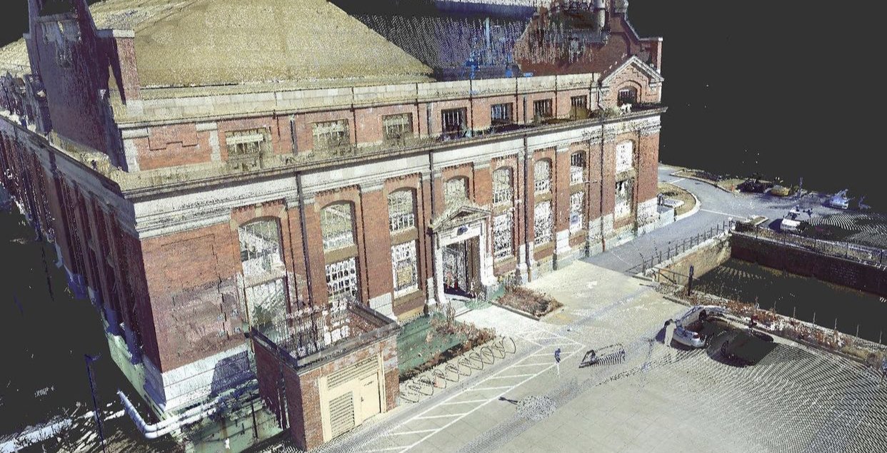
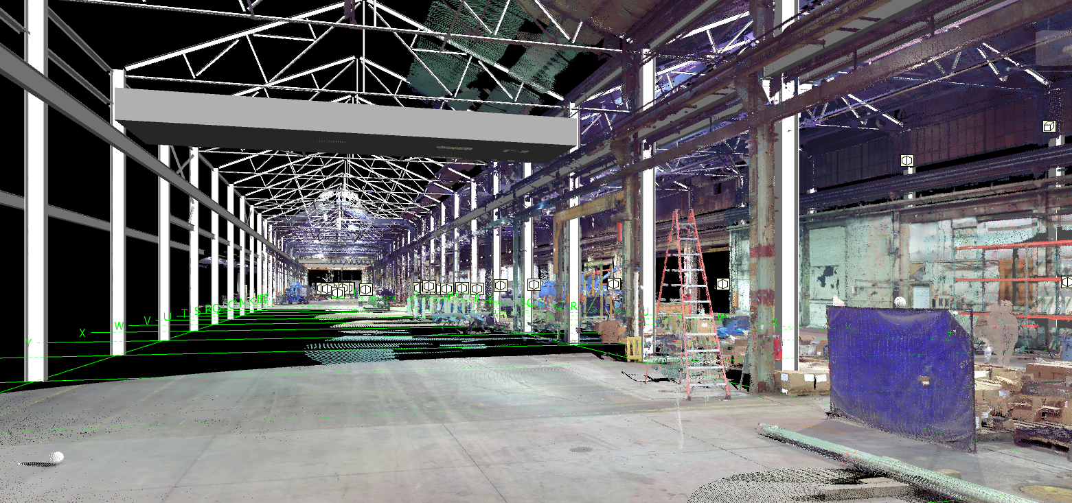
We deliver high-precision 3D laser scanning, BIM modeling, and subsurface utility locating using industry-leading Leica technology and advanced non-destructive investigation methods — producing accurate, data-rich visualizations of site conditions above and below ground.
3D Scanning & Modeling
Terrestrial and UAV lidar acquisition and post-processing
BIM modeling, rendering, and digital twin creation
Drafting, CAD conversion, and facility data integration
Clash detection and 3D virtual walkthroughs
Subsurface & Inspection
Utility locating, mapping, and GPR scanning
Leak detection and pipe inspection
Void and sinkhole characterization
Concrete scanning and structural analysis
All services are performed by certified technicians, delivering reliable, actionable data for projects of any scale.

Working Together
Great projects rarely happen in silos. In addition to our in-house capabilities in 3D laser scanning, BIM modeling, and subsurface utility locating, we collaborate with a trusted network of partners spanning geophysics, facility inspection, and AEC disciplines — bringing the right expertise to every project, whatever the scope.
The result is a single, cohesive experience from first conversation to final deliverable.
Why Choose Us
At Noble Precision Technologies, we know that bad data costs more than good data. That's why everything we do — from lidar acquisition to subsurface investigation — is built around accuracy, reliability, and delivering intelligence you can actually act on.
Our certified professionalsa bring deep expertise in 3D laser scanning, BIM modeling, GPR, and electromagnetic locating, with the field experience to know what matters and why. We work closely with clients across the AEC, municipal, industrial, and infrastructure sectors, adapting our approach to the unique demands of each project.
From scope definition to final deliverables, we're in it with you.
Contact Us
Get in touch for more information.